Kawah Ijen in 24 Hours from Bali, with Dinner and a Room
Hotel pickupGate fee includedFerry included
From $101 per person
Three things confuse people about where this volcano is. It sits on the far eastern tip of Java rather than anywhere near Bali. The trailhead is not the crater. And the crater is not the summit. Sort those out and every itinerary below starts making sense.
In the Ijen caldera at the eastern end of Java, on the boundary between Banyuwangi and Bondowoso regencies, about 8 degrees south. Banyuwangi is the nearest town of any size and the port of Ketapang, where the ferries from Bali dock, is on its coast.
The crater itself sits at roughly 8°03' south, 114°15' east. From the Bali side you can see the mountains it belongs to across the strait on a clear day, which is misleading: the crossing plus the drive plus the climb is most of a day and a night.
Ijen caldera, Licin, Banyuwangi Regency, East Java, Indonesia
Paltuding, about 1,850 m — the end of the road and the start of the walk
About 2,386 m, roughly 3 km and 500 vertical metres above the trailhead
Banyuwangi, 1 to 1.5 hours by road
Ketapang, for the ferry to Gilimanuk in Bali
There are two ways up, and which one you use is decided by your operator rather than by you. Almost every departure listed here takes the eastern road through Licin from Banyuwangi, because that is the side the ferry, the airport and the hotels are on.
The western road climbs from Bondowoso through Sempol, and it is the route used by trips arriving from Surabaya, Malang or Yogyakarta that overnight on that side. Both end at the same car park.
| Approach | From | Road time to Paltuding | Who uses it |
|---|---|---|---|
| East, via Licin | Banyuwangi | 1–1.5 hours | Ferry arrivals from Bali and anyone staying in Banyuwangi |
| West, via Sempol | Bondowoso | About 1.5 hours | Multi-day trips that overnight on the Bondowoso side |
| Ferry crossing | Gilimanuk, Bali to Ketapang | About 1 hour afloat | Every departure that starts in Bali |
| Road, Surabaya to Banyuwangi | Surabaya | 6–7 hours | The two-to-four-day packages |
| Road, Malang to Banyuwangi | Malang | 6–7 hours | The three-day trips with Tumpak Sewu |
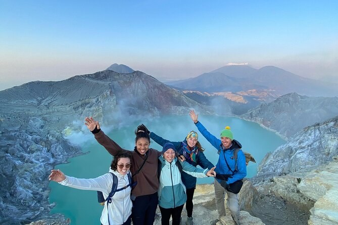
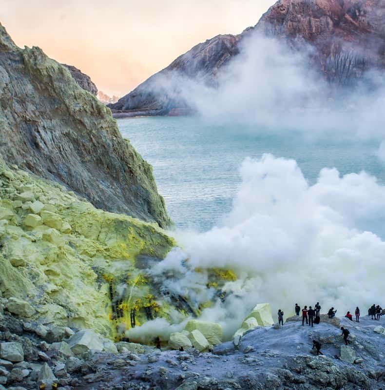
Paltuding is a car park at the end of a road. The crater is three kilometres away and 500 metres above it, and there is no vehicle access between the two. Every photograph you have seen of this place was taken after a ninety-minute walk that no itinerary can skip.
The other half of the confusion is the word summit. The rim path tops out around 2,386 metres; the highest point of the Ijen complex is Gunung Merapi at about 2,799 metres, a separate peak that no tour here climbs. Nobody on a night climb stands on top of this mountain, and nobody needs to.
Whichever way you arrive, the climb still starts at midnight. How the night is timed sets out the sequence, and a Mt Ijen tour handles the last hour of road for you.
The crossing itself is short. What makes a Bali trip long is everything either side of it: the drive across Bali to Gilimanuk, the queue at the ferry terminal, the drive from Ketapang, and then a 1am start on the other end. Elapsed time runs from about five hours for the shortest dash to a full 24 for the trips that put you in a bed first.
That is the whole argument between the two ways of doing this, and it is worth reading before you book. The Bali departures page lays out both, and every option is listed on Ijen Volcano Tours.
Yes, and seven of the listings here are built to do exactly that. The short version is a 5-to-7-hour night dash with a return ferry; the comfortable version is 24 hours with dinner, a bed in Java and a 1am start an hour from the gate. Both cross at Gilimanuk and come back the same way.
On six of the seven Bali departures, both ways. It is the Gilimanuk to Ketapang crossing and it takes about an hour, plus whatever the queue is doing that night. Where the ferry is not listed in the Includes block, budget for it separately.
The rim path where everybody stands is about 2,386 metres, and the lake surface sits roughly 240 metres below it. The highest point of the whole Ijen complex is Gunung Merapi at about 2,799 metres, which is a separate peak and not where the trail goes. Nobody on a night climb stands on the top of this mountain.
From $101 per person
From $500 per person